height profile
Description
When exploring today's stage, it is noticeable that we have already done such a similar stage - on the left bank on footpaths along the Traun - with little catering and sights. The main attraction is the river landscape of the Traun itself, where almost the entire route leads again. But only almost! Because the city of Marchtrenk has launched its own path of peace and this is part of the Jerusalem Way! The somewhat longer route than directly (optional) along the Traun is recommended for several reasons.
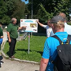
It offers catering and possibly overnight stays, gives us a welcome change in the monotony of today's stage and fits the topic to the Jerusalemweg Peace Trail. We pass the Traun power plant and a little later (a good 1 km) we see the right. Hand the fisherman's chapel. Immediately afterwards we branch off to the left and go north, reach the outdoor swimming pool - which invites us to swim on a hot day - go through the underpass of federal road 1 and have reached the center of Marchtrenk. At the small roundabout we keep left around the already visible cath. To reach the parish church. Here is also the first information board on our route on the «Marchtrenker Friedensweg». On the basis of various boards, pilgrims along the way are informed, among other things, about a huge prisoner-of-war camp from the First World War and about essential aspects of the settlement of Marchtrenk by displaced people after the Second World War. where now there are several catering options to make our well-earned break possible.
Strengthened and relaxed, we now follow the “Marchtrenker Friedensweg” northwards to Evang. Parish church, from there the path basically leads us back to the east, where we pass several Friedensweg panels and the path finally leads us southeast to the Traunufer, which we then follow further east or downstream. By the way, the stage destination Hörsching borders directly on the airport area of the same name south of the slopes.
Pictures
Facts & figures
Useful apps
We recommend the "Mapy.cz" app for use on smartphones and offline navigation.


