height profile
Description
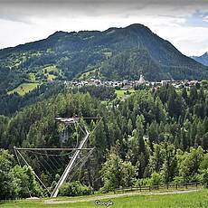
We have now arrived in the wide Inn Valley and could also find paths in the valley bottom on which we can hike comfortably. The route documented here offers views and sights that are worth the effort. A few pointers to these sights: Kronburg pilgrimage site: The pilgrimage church of Maria Hilf, located in the depression south of the Kronburg castle ruins, was built as a chapel in 1673. The Wallfahrtskirche appears as a simple, three-sided closed building, the tower rising on the west side of the pilgrimage church was only built in 1912. Kronburg ruin: The castle hill on which the Kronburg ruin rises today was settled in prehistoric times. A steep path leads from the pilgrimage site to the castle ruins, walking time approx. 15 minutes uphill. Between Arzl im Pitztal with the Café Herz As in the center and the idyllically situated district of Wald, we come to a highlight of this stage, namely the 94 meter high Benni-Raich bridge, which is not only used to cross a gorge, but also by the daring also for the sport or the test of courage «bungy jumping». On this route you will not only find many cozy accommodations but also the Ander´s Hofschank in Wald, which offers homemade delicacies and the Bungy Stüberl, directly at the Benni-Raich bridge with a wonderful view over the gorge
Pictures
Facts & figures
Useful apps
We recommend the "Mapy.cz" app for use on smartphones and offline navigation.


